Cirque of the Towers

The fourth year of summer backpacking trips, and this was maybe the best one yet! The Cirque of the Towers is a 23 mile loop in Wyoming, with two passes and endless lakes. This trail was a really beautiful place to spend a few days out of the heat and poor air quality that Colorado was experiencing this summer. It was definitely a trek to get there, but well worth it!
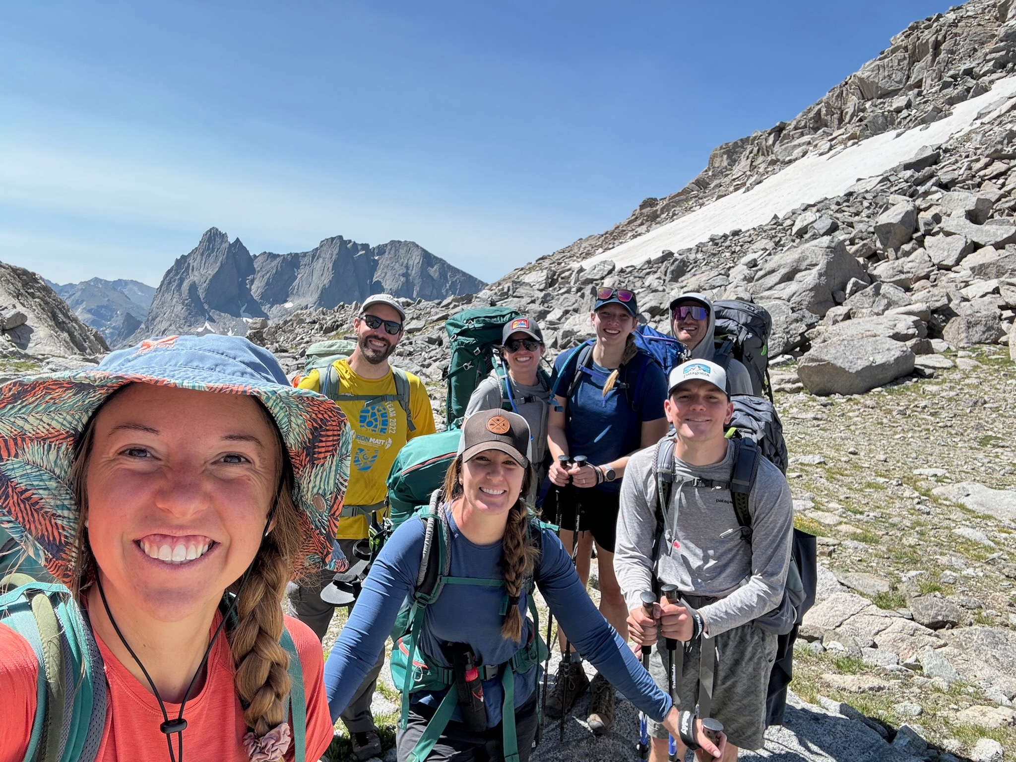
We drove to the trailhead on a Wednesday morning starting around 6am and made it to the trailhead before noon. We made sure to stop at the last gas station to get snacks and gas before we would be out of service for several days. (And we were glad we stopped for gas because we likely wouldn’t have made it back if we didn’t go with a full tank of gas.)

The first day was a fairly chill day of hiking, though it was a long day with a 6 hour drive. Once we made it to the trailhead, we hiked for about 7.5 miles. It was an elevation gain of 1,200 feet but it felt mostly gradual and flat. This took us about 4 hours to complete and then we went to work setting up tents, unpacking food, and making dinner for the night. The first night is always the hardest because you have to fit the most food back into your bear can and you are just not into the rhythm of setting up camp yet. So the set up of our tents and getting settled took a little longer than normal, but it was nice to be back on the trail and at a beautiful lake!

Campsite at Marm’s Lake the first night.

BUT THE STARS that first night were incredible! We have been lucky to have some really awesome sky views on several of our backpacking trips, and this was another great night! I highly recommend bringing a friend who has to get up in the middle of the night to go to the bathroom so that they will wake you up and tell you to come look at the stars. It will be 1000% worth it. Promise. The pictures below are good but still don’t capture the magnificence of the stars in the middle of nowhere!

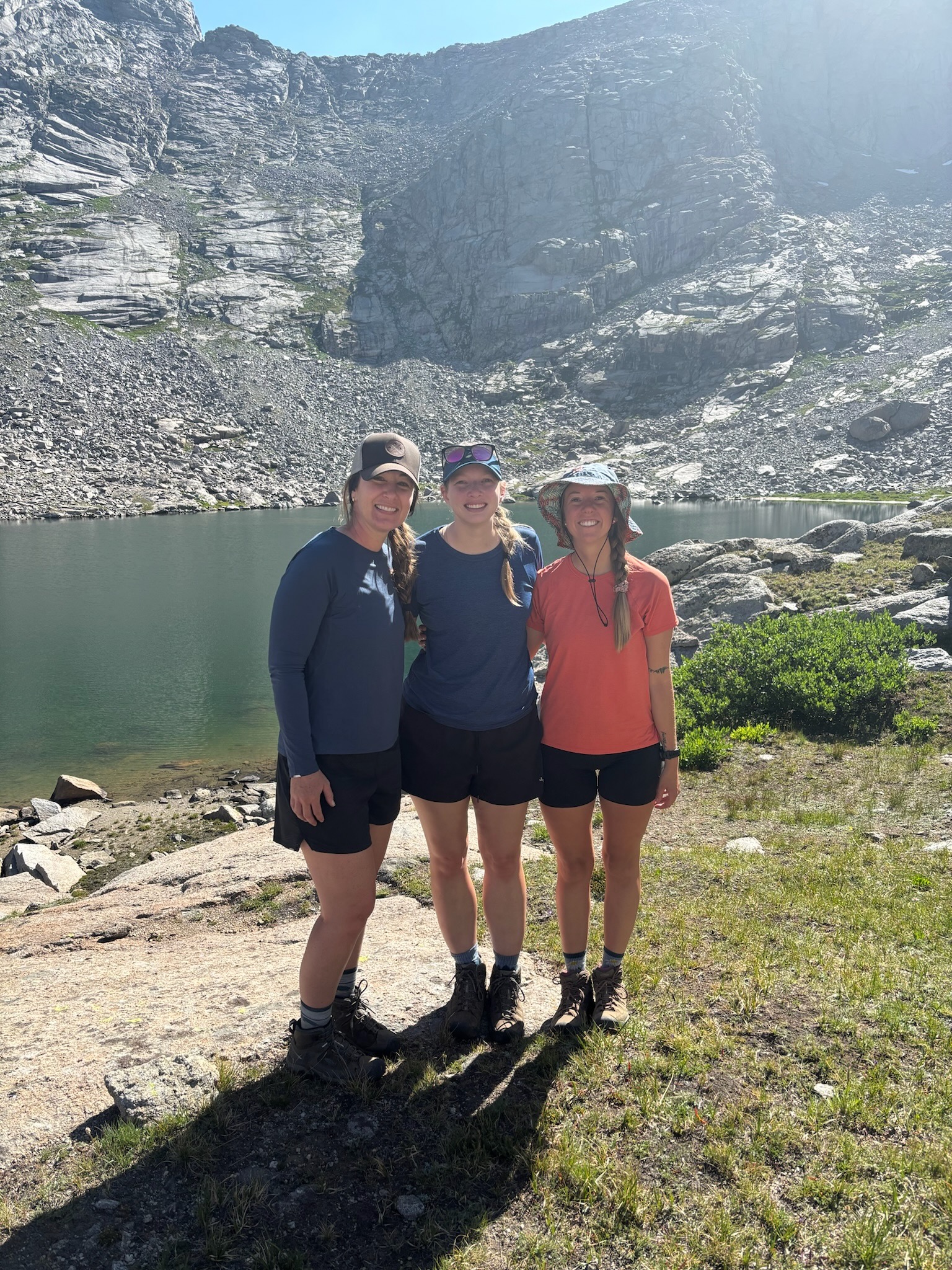
The second day was our easy day with a short 4 mile hike and a 500 foot elevation gain. So we took an easy and slow morning, and then spent the day chilling by our new home near Shadow Lake. We absolutely loved this lake! It was so peaceful! Plus, there weren’t a ton of people camping around that area, so we had plenty of space. We enjoyed the afternoon and evening, as we prepared for our big day next.

Day 3 was our hard day – 2 passes, 7 miles, and over 2,000 feet of elevation gain. …except that it ended up being closer to 9.5 miles and 2,500 feet of elevation gain. You see, the day started out well. We got all packed up and ready fairly quickly (for a crew of 7) and headed to the passes. We knew we needed to pack enough water to get over both passes because the water at the lake in the middle of the passes (Lonesome Lake) was not drinkable even with a filter. We also knew that we were likely going to have all sun and no clouds again, so we wanted to get up and over those passes sooner rather than later.

We made it to the base of the first pass at a decent time, but took a short break where we learned that there was a missing mom and 2 daughters somewhere. We thought we saw them with our binoculars but it turned out to not be them. (Long story short… it all turned out ok and everyone was found and reunited, but it did take some of our precious cool-air morning time. But we are so glad they are okay!) The first pass, Texas Pass, was definitely the hardest one. We spent a lot of time getting up and over this pass. There was a little bit of a snow field still left on the other side that we had to cross but it wasn’t terrible.

We made it to the bottom of Texas Pass and to the lake we couldn’t drink from. We decided it was time for lunch. We found a few shady trees and took a little bit of a break. It was getting really hot at this point so we really enjoyed the shade. Most of us put on more sunscreen and long sleeves after lunch so that we wouldn’t get too burned.

The second pass, Jackass Pass, was not as hard to get over though it was hot. Once we got over this pass, we headed down to Arrowhead Lake… and this is where things got tricky. There were two directions we could have taken: (1) up, around, and over the lake or (2) in the shade through the boulder field. We obviously chose the boulder field because we were so done with the sun at this point in the day. It didn’t look too terrible, but once we got into it, we realized there was not a way over the boulders with our packs on. This was devastating. We had spent so much time already over on this side of the lake and now we needed to filter more water and go the long way, adding another 2.5 miles to our journey. We were not excited.

At the top of Jackass Pass.

Once we regrouped and decided to go around, the only thing we could do is to just keep going. There was not another option and we needed to make it past this lake and the next lake before arriving at our destination for the night. It was long, and hot, and honestly really not enjoyable at all. But we made it… eventually. The only bummer was that by the time we made it to Big Sandy Lake, it was about 7pm and all the good camping spots were taken. So it took us a while to find a spot where we could all fit and ended up hiking to the far side of the lake.

Overall, day 3 was beautiful but also really long and tiring. I don’t know how we could have split it up any more than we did, but I am glad we made it. We were all so glad to finally be at the campsite. Plus it was finally a warm night (maybe even too warm). It was nice not to have to shiver all night in the cold though!

Our final day was a quick 5.5 mile hike out and all downhill. It was a very easy hike out which was nice. And then we headed straight to Big Sandy Lodge to get burgers! We loved that they had a lodge right by the trailhead because the next place for food would be several hours away. They were so kind and it was some really great food!

As a whole, I would recommend the Cirque of the Towers and I would do it again some day too! Some people do this trip in less time than we did, but I enjoyed getting time at each lake and time to slow down a little. Backpacking trips always make me so thankful to God, who created all of these beautiful places for us to explore!

The heavens declare the glory of God, and the expanse proclaims the work of his hands. Day after day they pour out speech; night after night they communicate knowledge. — Psalms 19:1-2 (CSB)

Mountains & Valleys

People often talk about the “mountain top experience” as the epitome of life. Its the best experience you could have! I think everyone will have a handful of these types of experiences where something incredible happens and completely changes your life.

But the reality is that most of our lives are actually spent in the valleys, in the mundane, in the everyday Tuesdays. And I think there is just as much beauty in the valley as there is on the mountain. Sure, the mountain gives you a new perspective, but you have to go through the valley in order to get to the mountain.

This summer, we backpacked in some of the most beautiful places in Colorado. As we hiked and hiked …and hiked… I contemplated this concept of mountains and valleys. Each time we got to a peak, I looked out and saw the valley we had trudged through. We had sometimes spent hours walking through these valleys that seemed to never end. Valleys that were often filled with a chilly wind that was relentless, or bugs that stuck to our faces and necks and arms without letting go, or rocks and uneven ground that was tedious, treacherous, and tough. But from up here, on the top of the world, on the mountain peak… the valley looked beautiful. It was wonderful and magnificent and perfect. We could see the green trees, lakes, and rivers and that was simply stunning! Sitting up here on the mountain, it seemed easy to forget the effort and endlessness of the valley which we had just traversed for a good portion of the day. We had made it to the summit!

And as we sat on the summit peak, I realized that sometimes you need to climb up the mountain just to see the beauty of where you were and how hard you worked. The view of the valley from the mountain top is what makes the mountain top experience so great. It’s understanding what it took to get out of the valley and up the mountain. That’s where the real beauty is.

The summit is never really the goal. (And I love myself a good summit!!) But the summit isn’t the end, in fact, the summit is typically only the halfway point. And each summit I reach there is a valley below that calls out and says, “Look how hard you worked to get here and look where you are now.”

The mountain top experience is about the person you are becoming as you climb. And for me, this is becoming a person who doesn’t give up, a person who knows that it will be hard and yet it will be worth it, a person who wants to learn how to be present even in the hardship and pain, a person who continues to lean on and trust the Lord even in the hardships of the valleys of life.

Last year held some difficult things for me, and in the moment they didn’t look beautiful. In the moment they seemed hard, and ugly, and painful. But as I catch my breath, as I continue to work at mental health, as I climb out of anxiety and depression… I can begin to see the beauty of the valley. And I can see where I was and the long hard road it took to get to where I am now. And I can see how God never left me alone in the valley, but rather continued to give me grace and rest each step of the way.

The Bible talks about the Christian life as being transformed one degree at a time. One degree is not a lot, but once you start to add these degrees up, it is much easier to see where you were! One step at a time. One degree at a time. That is the type of healing and the type of life that God has for us. Yes, he works in the big moments as well, but more often, he is simply with us in the everyday, long, and hard valleys of life.

And we all, with unveiled face, beholding the glory of the Lord, are being transformed into the same image from one degree of glory to another. For this comes from the Lord who is the Spirit.

2 Corinthians 3:18

There is beauty in growth. There is beauty in hardship. There is beauty in seemingly endless seasons of anxiety. But sometimes, you have to keep taking one step at a time to get to a place where you are awarded with some perspective. Others might not see how hard you have worked or the valleys you have trudged through, but you have made it, dear friend. And the journey is not over at the summit. In fact, it is just getting started!

Maroon Bells: Four Pass Loop

We headed out for our next adventure early on a Wednesday morning, after staying up way too late the night before trying to fit everything into our bear canister. (If I’m honest, one of the hardest parts of this whole trip was figuring out the logistics of passes and transportation. We had to get our bus pass early in the year, but we still had to figure out parking and transportation to the actual bus location at Maroon Bells. It felt like a lot for such a popular hike.)

Anyways, we made it to the Maroon Bells bus location with extra time to sit and rest before our 4-day, 3-night adventure truly took off. The bus ride itself felt like Disney World as the overhead speakers gave us background information on the mountains, animals, waterfalls, and rocks in the area. When we stepped off the bus our jaws dropped. We hadn’t even started our trek into the mountains and we were already stunned by the majesty of the mountains.

The first day was full of a lot of stops as we took pictures about every ten steps. We just didn’t want to miss anything and it was all so insanely beautiful! We hiked from the trailhead to Crater Lake and began our clockwise (CW) adventure around the famous Four Pass Loop.

(A note on direction: Everyone says that their direction — clockwise or counter– is the best…but our CW direction was definitely the best! We still aren’t sure how people did it the other way without dying, but again, I bet the CCW folks say the same about us. I still think we are right.) … 🙂

Our goal on the first day was to get as close to the first pass as possible without crossing. We knew the next day had 2 passes, so we wanted to get up a little bit into the elevation and a little further in the miles before setting up camp.

Once we hit the right miles and elevation, we started looking for a campsite and the one we found was actually perfect!! It was one of the best campsites I think we have ever stayed at. The views were unreal in every direction and we didn’t have other hikers near us at all. (Though we did have 1 or 2 deer friends who got insanely close every time we stopped watching them.)

Day one was complete, so we repacked our bear canister (seriously so hard to do on the first night…plus Parker and Hannah had a pickle situation that was kinda a nightmare…but also hilarious!!) and headed to bed. At about 1am we woke up and got to look at the stars. The moon was pretty small that night and the sky was completely clear. We could see the Milky Way cross the sky along with hundreds of thousands of stars. It was absolutely beautiful.

The next morning we woke up, ate some breakfast, packed up the tent and gear, and headed out for our 2-pass-and-lots-of-miles day. We made it to the top of the first pass in under an hour!

Then we began the descent through the valley and up the next pass. This was an incredible section that a lot of people do in a day. There is a trail that goes from Crested Butte to Aspen that is about 11 miles and you go over West Maroon Pass along the way. We met a lot of people doing that 11-mile trek and could follow most of the trail as it headed down the valley and into Crested Butte. But our trail eventually turned right and we headed up Frigid Air Pass, making it to the top in great time!

We headed down the pass shortly after and knew we had a lot more miles to go before we could set up camp. Our goal was to descend and get as close to the next pass as we could. The trek down was beautiful. We went through insane fields of wildflowers that absolutely blew our minds. Who knew so many different kinds and colors of wildflowers could grow in one field?! We stopped a dozen or more times to take pictures of the flowers, and this was definitely the highlight of the day. We also passed an incredible waterfall that was so tall and so loud!

We found our campsite towards the base of the next pass, right before the incline started. This site had its pros and cons for sure. One of the biggest cons was the mosquitoes and flies. They were everywhere, but they died down once the sun went down and didn’t return in the morning. The best part about the site though was the moose! There was a female (or maybe a young male) moose that hung out in the marsh right by our site that night and the next morning. It was so fun to watch it from a distance and continue to look for it in the trees and shrubs. We also had a great water-filling river on this night, including a spot to wash some of our clothes. We took full advantage of being near a river and enjoyed some good downtime after our long day.

The next day, we headed up the third pass, Trail Rider. We heard that this one was not going to be super fun, but we also knew that we were the freshest in the morning and it was the coolest time of day. We were eager to get to the top and get over the pass so we could spend time at the famous Snowmass Lake. We made it to the top of the pass in good time, though this pass was probably the hardest one for everyone in our group. Once at the top of the pass, you get an incredible view of Snowmass… and the view continues to get better as you get closer!

When we got to the lake, the clouds and light rain seemed to follow us. For a moment, it looked like we would be hiking in the rain the rest of the day. We packed up our stuff and started to leave, but then it cleared up! So we headed back to the lake with hopes of enjoying an hour or more at the lake. Thankfully, we had some good weather come in and we were able to sit and relax at Snowmass for a little while before packing up and heading closer to the base of the final pass.

Our final campsite was our least favorite, but we still found some great spots to hang out once we were set up. Plus we had an incredible meadow right by our site that was so peaceful and beautiful. We did have a little bit of an issue getting water at this site since it was really muddy, but eventually, we made it work! This was our final night on the trail and we only had one pass to go!

We got up early the next day so we could get over the pass in plenty of time. We had heard that this last pass, Buckskin Pass, was the hardest of them all and we had a time limit to get to the bus. So we headed out, fully ready to accept whatever challenges came our way.

And then… it was super easy. Like we made it to the top of the pass in record time and it wasn’t hard or technical at all. So maybe the backside going down was going to be harder? …but it wasn’t. There were a few spots of rocks, but it was nothing compared to some of our other hikes and even compared to some of the other spots on this trail. We still aren’t sure why everyone says this pass is so hard…

The rest of the way was pretty easy as it was all downhill. We made it back to the bus in plenty of time and even got to stop for lunch on the way home. Overall, Four Pass Loop is a 10 out of 10 recommend for anyone who enjoys backpacking. It is not an easy trail and you should definitely have some experience before you go, but it’s also not insanely difficult or demanding. I’m so glad we got to do this bucket-list trip and explore the beauty of the Maroon Bells!

Mt. Princeton

July 8, 2022: A day I will likely never forget. We started the day at about 5am as we headed to the trailhead for my 18th fourteener. My group included all friends, some of whom have hiked fourteeners with me before, and a few newbies. Overall, we were both excited and nervous about the adventure! I had read that this particular mountain was a class 2, meaning it was on the easier side, but I always remind myself and others that no fourteener is easy. This one had a lot of rocks, more so than a lot of others, so we were prepared to be in the scramble for a while.

We drove up and up. It was a little scary at times as our car felt like it was on the edge of a mountain (because it was), and very quickly the tops of the trees became eye-level. We passed a few cars that were parked on the side but decided to continue up, plus our map told us to keep going. So we did.

And then things went from okay to bad to worse within a matter of minutes.

We reached the end of the map (mind you: this included a lot of really difficult driving up some incredibly large rocks and divets but Lindsay was a champ…and she’s the MVP of this story as you will soon see). The end of the map was the actual trailhead. This is not where we needed to park though. And now we were on the side of a mountain… with a cliff on one edge… with nowhere to turn around. I remember looking over to one of my friends in the back seat and whispering, “This is the worst-case scenario.”

And it was. We were in big trouble.

We looked ahead and saw that the road got about 6 inches wider ahead so we drove there. We had to turn the car around. There was no other option. (I mean there was but that option included leaving a car on the mountain and a lot of money…) What happened next is truly a miracle. We spent the next 1.5 hours turning the car around on a mountain cliff, one inch at a time. The tires got stuck on the dry gravel multiple times, and we pulled the car up to the edge of the cliff too many times to count and enough times to cause us all to grow with anxiety and fear (and maybe a little sick to the stomach feeling mixed in there too).

There was a point where we legit didn’t think this car was coming off the mountain. No one actually said it out loud but we were all thinking it. This was one of those situations where you didn’t have time to truly think about what could happen next. You just had to figure out the best move you had at the moment and put all your chips in on that. At different points I think all six of us prayed out loud, asking God to save us and to save this car.

And then, it worked. We got the car out of the divet and out of the gravel. And it was facing exactly 180 degrees opposite of where it had been 90 minutes prior. It was a miracle. And we still don’t understand how it worked. (Again, Lindsay is the MVP here for her incredible driving skills and the Lord is the big hero for rescuing us and the car!)

The thing is, this was not the end of the journey. We still had to drive the car back down the large divets that we had gone up. At one point we had to all get to one side of the car in order for it to not flip. It was actually terrifying.

Now, you would think that this would be enough adventure for us in one day. But you would be wrong.

We got back down to the cars that were parked where we should have parked 1.5 hours ago (which we also thought previously were insane for parking that far down the mountain… we repented and gave them kudos for being smarter than us). We got out of the car, strapped on our packs, and headed back up the road we had just driven down…now on foot. Walking felt like a relief to us after this whole car endeavor.

Thankfully, we had checked the weather and we had a great weather window for the day, so we decided we could still complete the hike, even with an extra late start. The trail itself was not super fun. It was a ton of rocks and a lot of scrambling basically the whole way. I wouldn’t say it was hard but more tedious than anything. It seemed like the rocks just never ended.

We reached the summit, obviously a lot later than we had planned, but we were all alive and we had a lot to be thankful for.

We headed down the mountain, back to the car (which again, took forever because of the incredible amount of rocks), knowing that we still had a journey ahead of us. We had parked at a good location, but the rest of the road was still not awesome. And now, it was even harder. There were people coming up the road to camp for the night. (Again, this is a single-lane road made of dirt with a mountain on one side and a cliff on the other.)

Lindsay, once again, pulled through for us as she navigated and negotiated with the other cars coming up. We had a few tricky and tight passes, but honestly, after everything we had been through that day, this seemed like not a huge deal.

All that to say, we made it back safely with our lives, the car, and our bank accounts still intact. The car did have some damage, but it was honestly so minimal for what we had put it through, that it was a miracle in my eyes!

So today, as I sit and write this account, drinking coffee and remembering back to this insane adventure, I am thankful that God was with us and helped us turn the car around. I am thankful that I was with friends who did not freak out in a situation that could have been very easy to freak out in. I am thankful for Lindsay, who drove the car and turned it around on the side of a mountain cliff. I am thankful to have not been through this alone. I am thankful to be alive and without any injuries. And I am thankful that today, I am not on top of a mountain.

But don’t worry mountains. I will be back for you soon! Just next time, I think we will all triple-check the map and park in the right location. I prefer to have my adventures on foot.

Mt. Shavano & Tabeguache Peak

Mt. Shavano: 14,229 feet

Tabeguache Peak: 14, 155 feet

These 14ers were something else. And we may have thought we wouldn’t be getting off the mountain a few times. But we did. And we are never going back. Here’s the story…

We started out the day at 3am since we had a 3 hour drive to the trailhead. The hike itself started at 6:20am. After doing some research the day before, I estimated that it would take us about 6-8hours for the hike total. This was a double 14er, but it had three summits. In order to summit the second peak, Tabeguache, you have to first summit Shavano. In order to return from Tabeguache, you have to re-summit Shavano… there is no other way in or out.

Now, I’ve done double 14ers before and I’ve done some class 3 mountains too. Therefore, I was expecting this hike to be pretty straight forward. It was a total of about 11 miles, round-trip, and again, expecting about a 6-8 hour hike depending on how we were feeling. We also had absolutely perfect weather! No storms in sight and blue skies all day long, which is everything you could ask for on a hike like this!

The hike started in the trees at about 8,500 feet elevation. We hiked through a beautiful area of aspen trees and wildflowers, and then through a few miles of pines and evergreens. We enjoyed most of this section since it was in the trees and we were still fresh.

We hit the tree-line around 8:30am and continued towards the summit. This first section to the base of the summit was long, steep, and narrow. There were even a few spots with lots of snow still on the trail, causing our time to be slower than planned.

We made it to the base of the summit and headed up where it looked like there was a trail. Unfortunately, the trail ended pretty quickly and it became a “choose your own adventure” situation. A few people were already heading down from the summit, but they were coming down in all different parts. And there were several others going up at the same time as us, but again, all at different spots. We lost each other at one point and I remember thinking to myself, “Well, I hope we all find each other at the summit.”

When I made it to the summit, I realized how dumb I was to leave my friends. I’ve climbed a lot of mountains, and one of the first rules is don’t split up… and I had done just that. So I found a place to sit and rest, where the wind was blocked but I could also see most of the summit. And I waited. Eventually my friends joined me and we took a few quick pics.

After a quick chat, two of us decided to continue on while the other waited and rested. We had two waiting points. One was on the summit, and the other was the base of the summit. We knew we would all meet up at either of those locations in the next few hours. So we started our descent down the first, across the saddle, and up the second.

The problem was, there was also not a clearly marked trail on the second summit. We now believe that the trail ran across the ridge on the top, but that was completely snow packed and too slippery to hike up. So again we took the “choose your own adventure” route and headed towards the summit area by scaling the side of Tabeguache. We eventually made it and I was so thankful to finally be at the summit! …other than the fact that we were only half way done with the day and I was completely out of water.

We once again headed down the peak and across the saddle. This time we got to slide down a few “snow slides” on the way, which was both terrifying and amazing all at once! As we approached the summit for Shavano, we saw a flight for life helicopter. These are helicopters that are often called to the tops of 14ers to rescue people who fall, need some other medical attention, or get struck by lightening. I sometimes see these helicopters on my hikes, but this time was different because it was landing on OUR PEAK. In fact, it was landing in the exact place we had decided to meet up.

We began to pray for our friend and any other people who may be in danger and tried to get cell service to text our friend. Thankfully, she was okay and the helicopter was for another man who was severally dehydrated. I am so thankful for these men and women who come to rescue people on these mountains!

Anyways, we re-summited Shavano and then headed down to the meet up location at the base of the summit. But, as you know, we didn’t follow a trail up so we had no idea how to get down. I decided to head towards the right, but that was definitely the wrong choice. We ended up on the side of the mountain that was full of unstable boulders. It felt like a class 4 mountain and literally every step felt like a risk. My friend and I quickly realized the situation we were in. There was no trail on this side of the mountain, we could no longer see the trail we needed to get to, we were all alone, and we were in big trouble.

We were able to take one step at a time, maneuvering around and over boulders. We made it back to the correct side of the mountain, but still no trail. We were simply thankful to be back in eye-sight of our friend. We never truly found the trail on the way down, but did eventually make it down with only one bruised-up and bloody knee, and a few tears.

Even though it felt like we had just conquered the world by getting off the summit, we were still only at the base of the summit… meaning we still had a few hours of hiking. So we began to walk and walk and walk. Now, I know that a lot of people like downhill better than uphill because it’s easier on the lungs, but I sure hate downhills. They are the worst part of the hike for me because of the strain they put on your body. Even with trekking poles, it took us just as long to go down as it took to go up due to the amount of rocks and the steepness of the mountain.

We made it back to our car at 5:40pm with a total time of 11 hours and 20 minutes on the mountain. We had all run out of water a long time ago and were thankful just to be back at the car where we could sit and re-hydrate.

All this to say, these mountains were a beast. Maybe it was due to the fact that it was early June, maybe it was due to the extra snow on the trails, or maybe it was due to inaccurate trail reports from others. Either way, it was definitely an adventure… but one that I will never suggest anyone else to do.

I’m thankful for my friends, who hiked for 11 hours with me just to help me get a little closer to my goal of hiking all 58 14ers in Colorado. Here’s to #15 and #16. Never again, Shav & Tab. Never again.

2020: It’s Hard for Everyone.

I have a goal of climbing to the summit of every 14er in Colorado. (A 14er is a mountain that is over 14,000 feet elevation.) This is a tedious goal and one that will take me years to complete. I have summited 14 of 58 over the past 9 years, so I’m about a quarter of the way there!

The thing about 14ers is that they never get easy. It doesn’t matter how many 14ers you hike, they are always hard. And every single 14er is different. They have different elevation gains, terrains, and distances. The weather shifts and they each have their own difficulties.

The year 2020 has reminded me of 14ers in a lot of ways. It has been hard for everyone. It doesn’t really matter what you had planned for 2020 because it has changed… probably a thousand times. Some people have had much harder years than others, but no matter what, I know 2020 has been hard for you.

Friend, I pray that you will not give up. I pray that you will continue on even though it is hard. I pray that you will see that this year has been hard for everyone, and yes, maybe it’s been especially hard for you. But the fact that it’s been a hard year for everyone gives you a pretty wide variety of people to talk with who will likely understand and relate to some of your hardship. So lean into community, family, and friends. Let them hear your hardships, weep with you over the losses, and sit with you in the sadness.

Rejoice with those who rejoice, weep with those who weep.

Romans 12:15 (ESV)

I think the worst part about what most of 2020 has brought is that it encourages people to hide and remain in isolation. This is exactly where the enemy wants us. He wants us to feel alone, isolated, and afraid. He wants us to be convinced that we are the only one struggling or suffering, and that no one could understand or help. I know this is his desire because of what John 10:10 says…

The thief comes only to steal and kill and destroy. I came that they may have life and have it abundantly.

John 10:10 (ESV)

You see, the enemy is a thief who does not care for you or me. He only wants to steal our joy, kill our dreams, and destroy our lives. But Jesus came to give life. And not any life, an abundant, full life! He is the one who came to save us from hiding and isolation. He came to redeem us and give us true life. There are still hardships in this life with Jesus, but there is also joy, abundance, and fellowship.

The year 2020 has convinced many of you that you are alone. But I want you to hear today that you do not have to be alone. There is a God who sees you and cares for you. He sees your every need and created your very being. And He longs for a relationship with you.

2020 is hard for everyone. But if there’s anything I’ve learned in hiking 14ers, it’s that it’s way easier when you hike with good company. And in my opinion, the best company you could get is Jesus. Lean into Him. Ask Him to draw near. Spend time in His word. He is for you. And He is with you! May you be reminded of His nearness as we step into the last month of the year.

Uncrustable Weekends

If you haven’t had an uncrustable sandwich during a hike, you are missing out. And if you don’t know what an uncrustable is, here’s a quick run down. You can find them in a box in the freezer section at any grocery store. They are PB&J sandwiches that are ready to grab and go at any time. And let me tell you, they taste the best at the end of a hike.

This fall, my roommates and I have started a new tradition of going on hikes every Saturday morning. We typically leave the house between 4:30-5:30am in order to get to the trailhead right as the sunrises. This means that Friday nights are filled with intense searches on google for the best hike we can find, researching driving times and trail maps, packing up our gear, and heading to bed early for our long day.

Our first weekend, we went big and hiked Mt Sherman, which is a 14er (a mountain over 14,000 feet above sea level). This was my 14th 14er and I was excited to mark another mountain off the list, and introduce my roommates to these mountains!

Mt. Sherman’s trailhead starts above the tree line so the hike is not very long and it’s considered “easy” especially for a 14er. The elevation will still get you every time though! The mountain face is covered with rocks, so I also highly recommend bringing hiking poles since the rocks are extremely loose on the way down. Overall though, it was a good hike and one of the last really warm weekends to hike at this altitude. (We had an early snow three days later!)

The following weekend, we headed up to Rocky Mountain National Park for a re-hike of Sky Pond. This is a hike that two of us hiked earlier in the summer but we wanted to go back on a clearer day since it was really cold and rainy on the day we went. Since we had an early snow just a few days before, there were several areas of the trail that were snow or ice packed already.

When we got to the waterfall, we weren’t sure if we could still make it up due to the ice and snow. But we watched a few others go and then went for it. And it was worth it! We made it all the way to Sky Pond and it was beautiful…but very windy! Plus I just love the rock formations found at this lake!

The following weekend was the beginning of the aspen leaves changing color, so we went on an adventure to find some beautiful leaves! We ended up at Herman Lake Gulch. This was a great trail, but I was glad that we got there early! By the time we made it back to the trailhead, the parking lot was packed! This hike was about 3 miles out and 3 back. The first and third miles were pretty tough, but the second mile was really enjoyable. The trail ended at a lake, where we got to enjoy our uncrustables! But the way down was when we really got to see the beginnings of fall colors in Colorado!

The last hike for this post was our hike at Meadow Creek and Lily Pad Lake. This was the best weekend for the aspen leaves and they were absolutely stunning! We chose this trail because of the number of aspens along the trail! The Meadow Creek Trail isn’t labeled that well and it doesn’t really lead to a lake or the top of a mountain, so we went along this trail until we hit an open field and then turned around. The Lily Pad Lake hike is not that long, which is why we added on at the beginning, but it is beautiful!

We got to see some of the most incredible fall colors out there and it was a joy to spend the day in God’s creation with the vibrant colors!

There are many more adventures waiting out there for us, but so far, Colorado has been fun of some great adventures! Hiking may not be restful to many, but it is to me. It reminds me that I am part of something much larger than myself and that I serve a God who is big and who is also in the details of everything. So my encouragement to you is to get outside an enjoy God’s creation! As you do, express gratitude to God for His creation!

Oh also, #uncrustables … SPONSOR ME! 😉

Mt. Quandary

Mt. Quandary (14,265ft) was my 13th 14er and 3rd for the 2020 year. I hiked this mountain on July 21, 2020. Our total time was 6 Hours 25 Minutes, with a total HIKE time of 5 hours, 48 minutes. Two of my friends also went with me and we had a great adventure.

We spent the night in Breckenridge the night before, which is a great place to be. It’s only about a 10-15 minute drive to the trailhead from there and well worth it! We started at 5:57am. The beginning of the hike was pretty “easy” for a 14er. It was in trees and had some steep sections, but it was relatively good for the beginning of a 14er. Once you get out of the trees though, it was a pretty decent hike from then on…plus, there are a few false summits.

The best part about this hike was the mountain goat! We named him Billy and he was big and super close to the trail! At one point he did start walking towards us which was a little scary at first!

We made it to the summit by 9:18am and ate our Uncrustables sandwiches …which by now you should know is my go to lunch snack for all hikes. (#uncrustables…sponsor me!) It was beautiful at the top! You could see several lakes from there that looked like glacier water. Then we started the decent at 9:55am, reaching the parking lot by 12:22pm.

This was a great hike, and a relatively easy 14er. It was one friends’ first one and another’s second, but we were all traveling from Texas, low altitude, so it was a great hike for us. There were a TON of people on the trail though, even amidst Covid-19. I was really surprised by the number of people on the hike for a Tuesday! I was glad that we started before 6am and reached the parking lot before 12:30pm though. It seemed like a lot of people started around 8-9am and it would have been way more crowded of a hike.

Another great part of this hike was that after we were done, we only had a 10-15 minute drive back to Breckenridge! Staying in Breck really is the only way to hike this!

If you are looking for an easy first or second (or 13th) fourteener to conquer! The views are great, it’s a popular hike, and it should take you about 6 hours! Best of luck out there friends!

Sky Pond

I explored a new part of Rocky Mountain National Park (RMNP) that I hadn’t hiked before. My traditional hike is up to Emerald Lake, but we were in for a bigger, longer, and more difficult hike. And we definitely found it!

We hit the trailhead (after having to ride the shuttle because it’s #summer and everyone is in RMNP…) at 7:52am! This was a great time to start despite there being more people than I expected in the park during Covid-19….but it was a Saturday so that explains it a little.

Anyways, we started out the hike and it was honestly really easy. We read that this was a “difficult” hike yet nothing seemed difficult at all. It was a great trail, well marked, and extremely beautiful! We made it to Alberta Falls pretty quickly and stopped to take some pictures! The waterfalls along this trail were phenomenal.

We continued to hike and came to Loch Lake! This lake is INCREDIBLE. Seriously. Even if you only make it to this lake, it would be well worth your time. The trail hugs the side of the water most of the time so you have a great view of the lake as you make your way around. There were picnics and people fishing all around the lake. (On the way back we stopped to hammock by the lake for a little break, while we enjoyed the fresh air and great views!)

After hiking around the lake, the trail begins to get steeper, but still not at “difficult” level. There were a lot more steps and a steeper incline that led right up to the base of another waterfall.

Only this time… you have to hike up the waterfall! This is why this trail is marked “difficult.” Everything began to make sense!

(This is the waterfall we hiked up.)

We watched several people hike up and down the waterfall before it was our turn. By this point, there was a light off and on rain but either way we were going to get at least a little wet during this next section of the hike. We made our way up the waterfall, scaling the slippery rocks, helping each other out, and double checking every foothold to see if it was secure.

Once you make it over Timberline Falls, you reach Mirror Lake. This is the lake that feeds into the waterfall and it was marvelous! From here you have to hike around this lake to get to the final destination, Sky Pond. Now, this should be an easy thing to do, and it is if you know where the trail is, but we didn’t. We got some “directions” from a couple hiking down from Sly Pond who said, “Yeah, you just go up and around. It doesn’t really matter where you go, you will make it.” So we took that as a fact and headed over the rocks… and over the trees… and into the bushes… and then under the trees… and then we were lost. And yes, we did literally hike on top of trees.

So that happened, but we finally made it back to the trail. (And yes, there is an actual trail that was literally 20 feet away from us when we got directions from the misguided couple.) We made it to Sky Pond by 10:50am, which is a 3 hour and 2 minute hiking experience! We found a place to sit on some rocks, eat our uncrustables (which are now a required food item for all of my hikes!), and just gaze on the beauty of creation that stood before us. It really was unbelieveable.

Until it started to rain more than just a drizzle. Plus it was cold rain…not the warm, enjoyable rain, but the cold, sharp, almost hail kind of rain. So we shoved the rest of our food in our mouths, zipped up our raincoats, and headed back down the trail (the real trail) and towards the waterfall.

Everyone made it back safe and sound, and we rewarded ourselves with coffee at Kind Coffee…mostly because it’s a tradition of mine, but also because we needed some warmth!

If you are looking for a little (or a BIG) adventure, then Sky Pond is a great place to go. I hope to enjoy this hike several more times in the future since it was so beautiful. This honestly may be one of my top favorite hikes ever, which is truly saying a lot!

The reason why I love hiking so much is because you get to see the beauty and creativity of our Creator! He made each of the rocks you climb over and the particles of water that fall down into the rivers. He knows exactly where each tree was planted and how long it has been living. The beauty of God truly comes out in His creation and I love getting to explore new places in order to see even more facets of His creativity!

And the Lord will guide you continually
    and satisfy your desire in scorched places
    and make your bones strong;
and you shall be like a watered garden,
    like a spring of water,
    whose waters do not fail.

Isaiah 58:11

Belford and Oxford.

This post is a continuation of our backpacking experience, but it also stands alone as a play-by-play of our double 14er day hike up Mt Belford and Mt Oxford.

We woke up pretty early after a shorter night of sleep due to our lack of planning and a strenuous night hike into our camping location the night before. Because of this, our group split up and two of us went on the adventure for the day while the others spent the day resting and enjoying the fresh mountain air.

We began at 7:28am from our campsite, which was right below the treeline at about 11,000 feet elevation. This is the latest I’ve ever started a 14er, but we also were technically almost halfway up it already! It was an additional bonus to be able to hike during the daylight for the entire trek!

We made it to the first summit (Mt. Belford) by 9:45am, which is a 2 hour 17 minute time. It was faster than I was expecting us to go, but it felt nice to have one mountain down before 10am…and before the wind picked up.

Mt. Belford – 14,197ft. My 11th Colorado 14er.

We enjoyed some PB&J uncrustables at the top (which always taste the best on top of a mountain for whatever reason), and then started down the saddle towards our second mountain for the day, Mt. Oxford. The saddle took us just over an hour to complete (summiting at 11:30am), and it was extremely windy. The wind was the hardest and worst part of the day since it never really let up and we were completely exposed on the tops of the mountains and on the saddle.

Mt. Oxford – 14,153ft. My 12th Colorado 14er.

At the top of Mt. Oxford there is a small hole that you can sit in to be protected from the wind. This gave us a chance to catch our breath and consider how incredible the views are from the top of the world… as well as consider the goodness of the Lord knowing that every peak we could see belongs to Him!

For the Lord is the great God,
    the great King above all gods.
 In his hand are the depths of the earth,
    and the mountain peaks belong to him.

Psalm 95:3-4 (NIV)
One of my favorite pictures from our hike!

The only bummer about the Belford/Oxford combo is that you have to hike back up Belford in order to get down. There is no other way. So technically, we hiked three 14ers in one day. 😉

(The saddle. The trail is on the ridge on the left side of the picture. This is a picture taken from Oxford looking across to Belford. The Belford summit is the tallest point in the picture, which is the circular rock area at the center of the photo.)

We began the hike down the saddle and back over to Belford at 12pm and made it just under an hour, faster than our way over which we were impressed with! The backside of Belford is a beast! It is one of the steepest hikes I’ve done, making it difficult for both the way up and the way down.

Once we arrived at the summit of Belford for the second time, we took a nice, long break, enjoyed some food, talked with others who had just made it to the summit, took in the incredible views, and let the sun warm up our faces. The sun felt so nice after being in the wind for so long. We took our sweet time up there knowing that we only had a few hours left and it would likely be in the wind…again.

We began our descent at 1:46pm and made it to the campsite by 3:38pm, just under 2 hours. Our total time on the mountain was 8 hours and 10 minutes, though our actual hiking time was 6 hours and 23 minutes.

Overall, this was a great day of hiking and we kept an awesome pace all day. We also saw a TON of marmots and the tiniest chipmunks you have ever seen! This was a really fun addition to our day! The marmots seemed to be continually following us up the mountain and we were totally okay with that!

At the end of the day, here are some words we used to describe our hike: Difficult. Majestic. Hard. Content. Achieving. Perspective. Thankful.

Everytime I make it to the top of another 14er, I am filled with feelings of gratitude and awe. Gratitude for those who make the journey with me. Gratitude for God to give us mountains to climb, legs to walk, and lungs to breath (even if it’s very minimal amounts of oxygen). Gratitude for surviving at least half of the hike. Gratitude for being able to experience a view that very few people ever get the opportunity to see with their own eyes. And awe that God allows us to experience His creation at this level.

Mountains make me feel small and remind me that God is big! They show me that God is majestic. I was reading in J.I. Packer’s book Knowing God this week and he says, “The word majesty, when applied to God, is always a declaration of his greatness and an invitation to worship.” This is what the mountains do. They declare the greatness of God and invite us to worship Him because of this greatness!

Today, I’m thankful for friends who hike mountains with me for over 8 hours, and a God who is gracious and kind towards us in allowing us to experience His creation at new levels!